Surveying · Surveying
Surveying
Topographical Surveys
The measurement and mapping of land is key to building development for the future and essential for land administration and management.
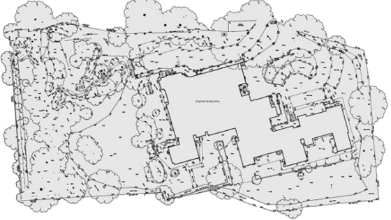 Cadmap produce accurate site surveys of the land for many different clients such as, planners, architects, designers and developers providing high quality topographical surveys for the design and future development of the projects. Land surveys indicate all ground related features on the site to their true position which is key for any design taking place. Cadmap's Land Surveyors operate Leica 1200 and 1100 series total stations and are fully trained with all aspects of land surveying and site setting out. All land surveyors hold current CSCS cards for entry on to building sites for any site engineering and are CRB certified for any school surveys that may be required.
Land, measured building and utility surveys delivered in accordance with applicable RICS standards and guidance, and PAS 128 for underground utility surveys where specified.
Producing a site survey of the land is important due to the impact on design requirements. Cadmap can produce level surveys showing contours in 2D and 3D model outputs, a level survey can be captured with GPS surveying equipment for relationship to OS grid and level datum alternatively the survey can be based on a local ordnance survey benchmark.
After the site work on any topographical survey is complete the data is processed then interrogated using Geosite Survey Office software. The raw data is quality checked and approved to ensure the accuracy of the land survey.
If you require a land or topographical survey in London, Sussex, Surrey and surrounding areas, please contact us or email a plan outlining the area you require surveying, with a specification and we will provide a free quotation within 24 hours, outlining our time scales and prices.
Measured Building Surveys
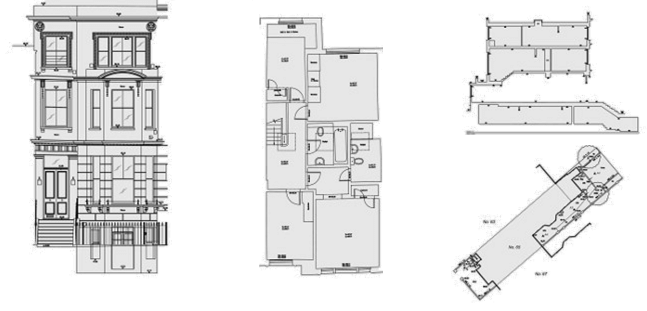 Cadmap provide measured building surveys for various reasons, whether it be Right of Light issues, Building Refurbishments, Record Drawings, Listed Building Survey, Heritage Surveys, As Constructed or Extensions for planning.
The requirements that are common in terms of measured building surveys are elevation surveys, measured floor plans, cross sections, street scene elevations. Cadmap's Building Surveyors operate Leica 1200 series total stations and are fully trained with all aspects of building surveying. All building surveyors hold current CSCS cards for entry on to construction sites for any building surveys and are CRB certified for any school surveys that may be required.
Land, measured building and utility surveys delivered in accordance with applicable RICS standards and guidance, and PAS 128 for underground utility surveys where specified.
If you require any of our services please contact us or email a plan outlining the area you require surveying, with a specification and we will provide a free quotation within 12 hours, outlining our time scales and prices.
3D Laser Scanning
Building information modeling (BIM)
Cadmap provide all aspects of 3D laser scanning.
The Leica P20 Scanner can scan up to 1 million points per second Leica Scan Station P20 is the ideal instrument when very short time windows are available for capturing High-Definition Survey data or when ultra-high density is required.
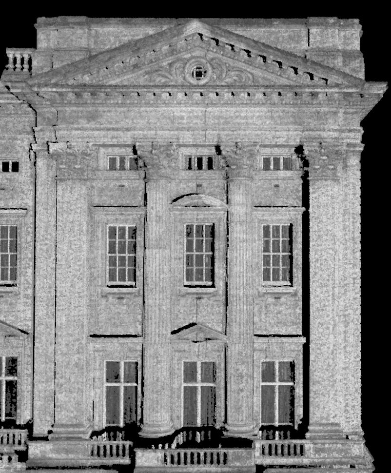
From building elevations to internal floor plans and more specialist projects we have the experience and expertise to accommodate your project.
The data we capture can be rendered to a high standard using the latest CGI software such as REVIT and 3DS MAX.
Additionally we can provide raw point cloud data if there are no presentation requirements.
Cadmap created a video of a Boeing 747 at the famous Dunsfold Aerodrome (The home of Top Gear).
To view the video click here
Boundary Surveys
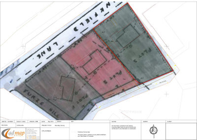
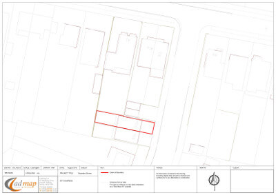
To survey a boundary requires experience and the correct equipment to do the job. Disto and tape measures are not accurate enough to survey a boundary.Whether you require a boundary survey to dispute an encroachment from a neighbour, to register a new plot of land to the Land Registry or just obtain a plan for your records.Cadmap provide these services on a regular basis to a variety of people.
The standard procedure for a boundary survey is as follows:
Step 1 - Site visit to survey the existing boundaries, buildings and surrounding fixed details using the laser, this provides enough information to enhance the Ordnance Survey and Title plan overlay to be more accurate.
Step 2 - Office drawing work to overlay and fix the survey information to supporting documents such as Land registry title plans and OS-Data.
Step 3 - Provide a report to the client indicating any boundary discrepancies.
Step 4 - If necessary return to site and set out the new boundary line using wooden pegs and bunting.
 |  |
Underground Services Surveys
London based Underground Utility Surveyors specialising in GPR (Ground Penetration Radar) surveys, Radio Detection Scanning, Drainage Surveys and CCTV Drainage Condition Surveys.
Cadmap Utility Surveying is a highly professional Underground Utility Surveyors, we specialise in the mapping of underground services accurately on the ground to show a full representation of existing services running through the potential development site or highways.
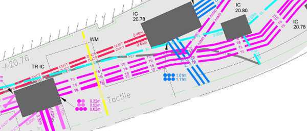 To locate the position of underground services and pipes is critical before any excavation work begins, to avoid a potential disaster. Undertaking an Underground services report gives you the vital information required to avoid such problems. All services located and mapping accurately plotted onto a CAD drawing using Leica Total stations and can be delivered in a variety of file formats.
Cadmap Underground Surveying professional staff operate the latest in Ground Penetration Radar technology such as the IDS Detector Duo and Radio Detection RD8000. CCTV Surveys are carried out operating the MiniCam Solo Pro 60 Meter Drain Camera and Wincan V8.
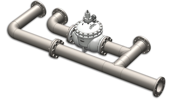 Drainage Investigations.
Cadmap attend site equipped with an original land survey which shows the position and the level of manhole covers. Manhole covers are lifted in a safe and secure manor to ensure no danger is at risk to the public. Invert readings are measured, direction of flows are established and pipe sizes noted along with sewer construction, either foul or surface. This information is then added to the existing survey, all connections, invert levels and direction of flows are clearly presented on the drawings.
Underground Utility Surveys
Cadmap attend site equipped with an original land survey which shows the position of all service covers. The surveyors traces underground cables, pipes using Radio Detection methods and equipment such as the RD8000 Detector and TX10 Genny. This information is then added to the existing survey, all connections, depths to pipes or cables direction are clearly presented on the drawings.
CCTV Surveys.
Cadmap attend site equipped with an original land survey which shows the position and the level of manhole covers. Manhole covers are lifted in a safe and secure manor to ensure no danger is at risk to the public. Invert readings are measured, direction of flows are established and pipe sizes noted along with sewer construction, either foul or surface. using a CCTV device and cable crawler we video the chambers and pipes which show conditions of the runs and would show any blockages or damage. This information is then added to the existing survey, all connections, invert levels and direction of flows are clearly presented on the drawings.